Satellite Image Analysis (Remote Sensing) and Field Verification
Service Description:
The second service combines digital analysis using satellite images with actual on-site fieldwork to pinpoint well-drilling locations with higher accuracy. After initial analysis using satellite data, the results are confirmed through a site visit with advanced field technologies to accurately measure groundwater indicators on-site.
Benefits:
- High accuracy:
Satellite image analysis is used to provide accurate estimates of groundwater presence, while field verification enhances and confirms these estimates. - Real-world inspection:
Field verification allows for direct site examination, testing satellite analysis assumptions with specialized field equipment. - Comprehensive analysis:
This service merges the advantages of modern technology (remote sensing) with real-world field observations, providing a more thorough and accurate analysis. - Higher well-drilling accuracy:
By combining remote sensing analysis and field confirmation, well-drilling sites can be determined with higher precision, aiding in accurate decision-making for drilling operations.
Process Flow:
- Phase 1 – Satellite Analysis:
- Collect satellite data imagery
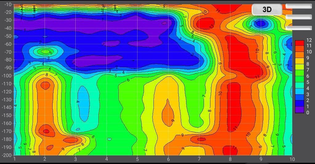
- Analyze the images to generate digital maps revealing information about topography, vegetation, and hydrology indicative of potential groundwater presence.
- Extract basic site information such as elevations, slope, and geological type.
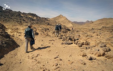
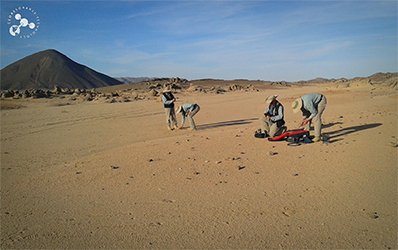
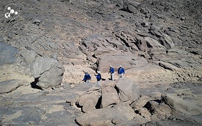
- Phase 2 – Field Verification:
- On-site visit using remote sensing field technologies
- Measure groundwater indicators, such as the groundwater table level and estimated well depth.
- Collect soil samples (if necessary) to analyze properties that contribute to the accuracy of the analysis.
- Phase 3 – Reports and Maps:
- Prepare a detailed report that combines the satellite and field analysis results.
- Create digital KML maps showing potential drilling points based on the combined analysis.
- Provide estimated groundwater depths for each potential well point.
- Delivery:
- Deliver the client a detailed PDF report containing all findings, analysis, and maps.
- Provide KML maps for download.
Expected Results:
- Accurate identification of optimal well-drilling locations using combined satellite and field analysis.
- Estimation of groundwater depth for each site, aiding in cost and feasibility assessment for drilling.
- A comprehensive detailed report providing accurate data and actionable recommendations for the project.
Key Benefits for Clients:
- Double the accuracy in groundwater estimates.
- Field verification enhances satellite analysis results.
- Comprehensive reports support informed decision-making for drilling operations.
- Quick execution by merging fast satellite analysis with field testing.
Pricing:
- Our services start from 300 USD
(Prices may vary based on site location, project size, and land characteristics)
Benefit from the Service:
This combined satellite and field verification approach is ideal for clients seeking guaranteed accuracy before starting any drilling work. This method helps save effort and resources while ensuring precise results for groundwater detection.